Trails in Marple Township
Click or tap on the "four corners" icon (upper right) to open a larger full-screen map.
Click or tap on the small box icon (upper left) to open a list of trails.
Click or tap on a trail or its listing to see its details, length and maybe a photo.
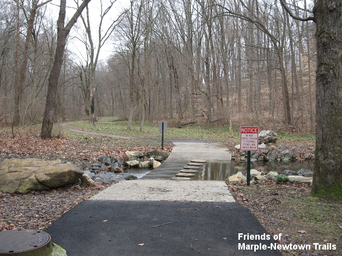
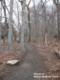
Kent Park: The best number and variety of trails in Marple Township is in the township's Kent Park off of Cedar Grove Road (not to be confused with Delaware County's Kent Park along Darby Creek in Upper Darby Township). The level Macadam Trail (0.30 mi.), leading back through the park from the parking area, is accessible at least as far as a ford over the small stream. There you have the choice of using the flat-topped "stepping stones" built into the concrete ford structure or walking/wheeling through a few inches of water on the flat surface of the concrete. Alternatively, cross the footbridge near the parking area, then turn left and follow the earthen Woods Trail (0.17 mi., marked with blue blazes on tree trunks) along the wooded hillside. It meets the Macadam Trail on the other side of the ford. Partway along the Woods Trail, the earthen Hill Trail (0.08 mi.) climbs up the hill and leads to a flat clearing with the stone remains of an old house foundation. The earthen Ballfield Trail (0.12 mi.) leaves the end of the Macadam Trail to climb up to this same clearing and then beyond to the adjacent Thomas Field ballfield complex. All of these trails can be combined into loops of varying length and difficulty.
Veterans Memorial Park: The 0.30 mile macadam Loop Path is popular for walking, running and casual cycling. While there is not a well-defined earthen trail, you can also walk back into the far meadow and gradually down through the woods beyond, taking a Woodland Walk (0.28 mi.) as far as the fence of the swim club. Marple Township has undertaken a study for Veterans Park, which is much larger than the cut-lawn area. Concepts include additional trails within the larger site, plus short connector trails from the present Loop Path to adjacent neigborhood streets like Rose Lane and Concord Road, which would offer direct access from these neighborhoods and between them.
Hildacy Farm Preserve: This open space hosts a network of natural walking trails, including the Red Trail (1.54 mi., which can be split into the shorter Yellow Trail and Green Trail) and the Purple Trail (0.32 mi.). The preserve, which serves as the headquarters of the Natural Lands Trust, is located just downstream from the Springton Revervoir, off of Palmers Mill Road. While there, be sure to check out the reservoir fountain at the end of the short Springton Reservoir Fountain Trail (0.08 mi.).
 |
Glenwood Cemetery Path: Perhaps the oldest suburban trail in Marple, this short (0.15 mi.) and narrow path runs through the trees at the rear edge of the cemetery along Marple Road. The rough and irregular macadam ends at an access road, but you can continue to walk respectfully along the periphery of the cemetery to Anthony Avenue, and then alongside Anthony down to Amber Court, where the sidewalk begins. The Glenwood path, while tired and small, has its own quirky appeal and should be on your "I've done that one" list. |
New Ardmore Avenue Park: While it has no real trails, you can walk the perimeter of this park, located on New Ardmore Avenue. At the back of the park, if there were a small pedestrian bridge over Langford Run, it would be possible to continue a trail through the woods to Langford Road, offering additional access from that neighborhood. Someday, a further trail connection to the back of Veterans Memorial Park might be possible as well.